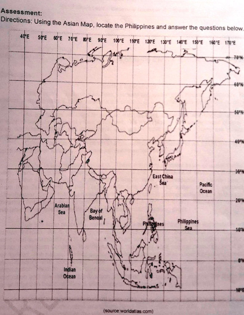
Assessment: Directions: Using the Asian Map, locate the Philippines and answer the questions below.. 40°E 50°E 60°E 70°E 80°E 90°E 100°E 110°E 120°E 130°E 140°E 150°E 160°E 170°E 70°N Arabian Sea Indian Ocean Bay of Bengal 60°N 50°N 40°N 30°N East China Sea Pacific Ocean 20°N Philippines Philippines Sea (source:worldatlas.com) 10°N 0°N 10°S
The Correct Answer and Explanation is:
Based on the image provided, it is not possible to provide the correct answers as the questions themselves are not visible. The directions state, “Using the Asian Map, locate the Philippines and answer the questions below,” but the image only shows the map and not the accompanying questions.
However, I can provide a detailed analysis of the Philippines’ location as depicted on the map, which is the prerequisite for answering any related questions.
The map shows the Philippines as a prominent archipelago located in Southeast Asia. Using the provided latitude and longitude lines, we can determine its absolute location. The country is situated entirely north of the equator (0° latitude line), placing it in the Northern Hemisphere. Its latitudinal range on this map spans approximately from 5°N to just under 20°N. Longitudinally, it lies to the east of the Prime Meridian, placing it in the Eastern Hemisphere. The archipelago is positioned roughly between the 117°E and 127°E longitude lines. This specific location within the tropics has a profound impact on its climate, which is typically hot and humid year round.
The map also clearly illustrates the Philippines’ relative location with respect to major bodies of water and landmasses. It is an island nation with no land borders. To its east, the map labels the Philippine Sea, which is a marginal sea of the larger Pacific Ocean, also indicated further east. This vast ocean separates Asia from the Americas. To the north of the Philippines, the map shows the East China Sea. While not explicitly labeled, the body of water to the west, separating the Philippines from the Asian mainland (specifically Vietnam and China), is the South China Sea. The Asian mainland, including China and the Indochinese Peninsula (containing countries like Vietnam, Cambodia, and Laos), is situated to the west and northwest. To the south are the other islands of the Malay Archipelago, such as Borneo and the islands of Indonesia. This strategic maritime position has historically made the Philippines a crucial hub for trade, cultural exchange, and military strategy in the region.